Cocodrie Louisiana's Inside & Offshore Fishing Information
Cocodrie Louisiana's Inside & Offshore Fishing Information
By Jerry LaBella
It has been acclaimed as one of the best inshore fishing spots on the entire Gulf Coast. It's terrain vaunts a vast area of inside bays and Gulf-bordering sand, shell, and marsh islands. Isle Denieres, big barrier islands to the extreme south of Cocodrie, punctuate the Gulf's coastline, acting as a stalwart defense line to its delicate interior.
It is a haven where pelicans, seagulls, and skimmers ceremoniously swarm the beaches, awaiting the call of daybreak to garner the overflowing sea life. Cocodrie is also the gateway to the well-known Lake Pelto, which lies just west of Terrebone Bay. Lake Pelto's western border is composed of mazelike marsh islands that reach down to touch the central backside of Isle Derrieres, which forms the southern boundary of the lake.
Further west is Caillou Bay, also bordered on the south side by the western portion of Isles Derrieres. Rich marshland forms the northern border of both bodies of water.
The famous Isle Derrieres runs approximately 19 nautical miles from end to end. And for reference purposes, this article will imaginarily divide it into eastern and western portions; the designated split being centrally located Whiskey Pass–one of several entrances to and form the Gulf of Mexico. Other openings along the barrier island chain yield shallow water that might not be navigable with deep-draft boats. However, Wine Island Pass, located to the extreme east, and Raccoon Point to the extreme west of the island, offer other alternatives around the barrier island chain.
The Atchafalaya River, like the Mississippi to the east, strongly affects the brown, inshore waters that may extend some 20 miles seaward. Here the bottom is comprised mostly of sand and mud. In comparison to other locations along Louisiana’s shores, the blue water zone is relatively far offshore.
In both bays and near shore there are many gas and oil platforms that pepper the scenery, making for ideal bait holding grounds that draw all types of predator fish like speckled trout, sheepshead, and redfish (red drum).
The main navigational canal for this area is the Houma Navigational Canal (H.N.C.), which from the Cocodrie launches can easily be accessed from Bayou Petit Caillou. Heading south down the H.N.C. will put you into Terrebone Bay.
The H.N.C. continues and is channeled between Timbalier Island to the east and Isles Derrieres to the west. At this point, the channel is called Cat Island Pass and is buoy marked out into the Gulf of Mexico.
Anyone who enters this wonderland on a clear day, peers out across Lake Pelto from the northern side, and scans the islands scattered about, has no problem imagining that he's entered a tropical paradise.
These wetlands are considered to be some of the most prolific producers of fishery resources due to geographical design and network of brackish water systems to the north. Perhaps this is one reason why finding fish doesn’t seem to be too difficult for many, even for first-time visitors.
In this article, simple recommendations as to the where, when, and how will be outlined for both the experienced and novice alike. In the context of this information, the area of Cocodrie is referencing territory from 10 miles offshore in the Gulf, spanning an area a little more in width than Isles Dernieres, and moving north parallel with Cocodrie. This, of course, is an imaginary boundary but will give a better idea of locations under discussion. Areas to the north, deep into the marsh of Cocodrie, are very productive during winter months, but only the experienced should attempt a deep run therein due to the complicated network of marsh and man-made canals that form intricate mazes.
Basically, Lake Pelto and Caillou Bay are shallow, saltwater bodies of water with maximum depths of 6 feet. There are islands scattered within Lake Pelto which may be surrounded by water less than a foot in depth.
During the colder months, one should concentrate on some of the deep cuts, such as off Wine Island Pass, Whiskey Pass, and Cat Island Pass. While Raccoon Point is not considered as deep as the aforementioned, it too, can be productive. Flowing water from in and outgoing tides has dug underwater channels here which are main routes for both bait fish and predator species.
 Redfish can be caught in these areas on good incoming tides all year round. The eastern shore of Whiskey Pass has excellent bottom terrain consisting of hard sand and oyster shells.
On the western side of this pass, at Bay Round, an oyster reef is located which forms a small island. This is a well-known redfish and speckled trout spot, usually fished with live cocahoe minnows and a popping cork.
Many that fish this area know the importance of bringing their own live bait, since it is not always available at most bait stands. Thus some catch their own with the use of a cast net or minnow trap. Two excellent live bait areas are along the eastern side of Whiskey Pass near the Gulf at Isles Dernieres and the interior section of the island at the same location.
A word of caution, however, on a high tide the water depth along the shore of Whiskey Pass can get deep all the way up to the beach. Therefore It's best to anchor as close as possible to the shore and check the water depth with a pole before wading to the bait grounds.
Speckled trout fishing along the entire beachfront and backside, and especially where narrow channels cut through the island, is quite popular with wade anglers. Large specks show up as early as March along these barrier islands, with the warmer months producing mostly school speckled trout.
Sand trout (white trout) also abound, preferably when seasonal salinity is reduced. Their migratory movement from the bays into the Gulf begins with the onset of cool weather.
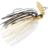
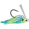
Numerous artificial baits work well at times, such as the local favorites like Mirr-O-lures, stingray grubs, sparkle beetles, and cocahoe minnow lures. The latter three are sometimes fished in tandem and the hooks are sweetened with fresh shrimp pieces.
While it's not uncommon to see oil production rigs and platforms throughout Louisiana's waters, it is unusual to see attaching catwalk (bridge walk) structures that run over a mile in length. Not only do these abound throughout the bays, some of them extend out to form L shape patterns. These abandoned structures, which act as natural reefs, make for excellent fish attractors since they provide food and cover for several different species.
The trek from Lake Pelto to Caillou Bay via inside waters from Cocodrie may present a problem to some first-timers. This is due to the centrally located shallow marshland that separates the two bodies of water. While it is true that the more experienced natives find their way through to Caillou Bay via Bay Round, Bay Wilson, or Pelican Lake, the novice may find it easier to follow the buoy markers located in Lake Pelto that lead into Caillou Boca.
These markers can be located by heading southerly toward Whiskey Pass near the western side of Lake Pelto. The markers also run from east to west through near midsection of the lake. This is the preferred inside route since going around through the Gulf of Mexico via Whiskey Pass can be a rougher ride if winds are southerly and brisk. Furthermore, from Cocodrie this route is a shorter run to the western tip of Isles Dernieres (Raccoon Point).
The northern border of Caillou Bay, especially Pass Wilson, Grand Pass des Ilettes, and Bayou Grand Caillou are winter hot spots for speckled trout and redfish on falling tides. The ledges along Caillou Boca (between Callou Bay and Lake Pelto), Whiskey Pass, and the Houma Navigation Canal from south of Cocodrie are excellent bottom fishing spots for bull red and black drum fish. Anglers fishing these spots like using cracked blue crab or cut mullet on Carolina rigs (sliding sinker rig).
The deep running channels off of Wine Island Pass, near the Gulf of Mexico and Cat Island Pass, are well-known bull red fishing spots, particularly in the fall. And, the hard-core bull redfish hunters that can brave cold, full-moon nights can literally wear themselves out catching these hefty breeders– especially on incoming tides.
For the most part, Cocodrie is a shallow-water haven, except for the deep running channels and passes such as aforementioned. However, with the use of a depth finder one can find some productive underwater channels near certain island opening and passes.
For example, one underwater channel that can be located is near the backside of the western portion of Isles Dernieres at the extreme south portion of Caillou Bay. This particular channel appears to have been formed by the out flowing waters of Bayou Grand Caillou, located to the north. It evidently runs across Caillou Bay as it flows southward all the way to the middle opening of the western section of Isles Dernieres at the Gulf.
To pinpoint its location, scan the area with a depth finder by traveling from west to east or visa versa (see Loran C coordination below). The average surrounding water depth is about five feet, but when you cross the channel it drops to 11 feet. The channel is not wide but seems to run in a zigzag pattern as it crosses the bay toward the island. Fishing underwater channels like these can yield redfish, speckled trout, black drum, and white trout.
The Sulfur Mine, located south of Whiskey Pass and well into Lake Pelto, is another popular hot spot to fish. This old, abandoned sulfur mine can be identified by its pinkish hue and surrounding buildings which presently serve as camp sites. The installation sits on an island bordered by rock boulders, cutoff drilling pipes, pilings, and seashells. The drilling pipes on one side of the mine form a wall that ascends 34 ft. above the waterline. These pipes were placed next to each other to extract sulfur from a once flourishing mine. Now they serve to extract anglers from near and far.
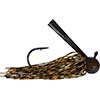
Those with shallow-draft boats like to fish near the piling openings which lie to the right of the pipe wall. This is where the wary and often biggest redfish and speckled trout like to lurk under the cover of debris. Lures of choice include slow-sink Mirr-0-lures, Top Dogs, and Rapalas in various colors.
In regard to near-shore rigs and wellheads, there numbers are few when compared to those that lie further to the east. Nevertheless, fish like aforementioned abound throughout; and during the summer months big speckled trout seekers target them by fishing the bottom with live croakers on Carolina rigs.
Cocodrie is indeed an outdoor fishing menu of pleasure that awaits all those who fish it– both inside and offshore!
|