LandBigFish.com
Fishing Tackle Marketplace
CALL TOLL FREE 1.877.347.4718
Available Mon-Fri 9AM - 5PM EST
You Are Here:  Home ❱ New Search ❱ Campground Showcase
Beech Fork State Park

  
Contact Information

5601 Long Branch Road
Barboursville, West Virginia 25504
Phone: 304 528-5794
Fax: 304 522-3298

Website / Email
Send Email: Send General Inquiry
Reservation Request: Send Reservation Request
Company Description

Beech Fork State Park was officially opened in the winter of 1979 and offers 3,144 acres of some of the best recreation experience in the southwestern section of West Virginia.

Beech Fork is located 12 miles south of Huntington and Barboursville and is just a short drive from Charleston, Cincinnati and Lexington.

Developed by the U.S. Army Corps of Engineers in the mid 1970's, Beech Fork Lake has owned up to its popularity for recreation boating, fishing and wildlife watching experiences.

Many varieties of migratory water fowl, neotropical songbirds, raptors, whitetail deer, fox, even an occasional passing black bear may be viewed while visiting the park. The early spring brings with it the welcome call of different species of frogs and toads.

Spring wildflowers are a common sight to hikers and those who look carefully as they walk or bicycle along the roads and trails. Fishing is one of the most common activities that visitors and overnight guests may enjoy.

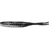
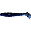
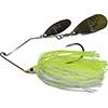
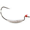
The lake is known for largemouth and hybrid striped bass, catfish, walleye, saugeye (a cross of walleye and sauger), and bluegill.

A Fishing license is required and is available in the Camper's Corner store located in the Administration Building. The store is open for business March 15 through October 31.

Deluxe Cottages:: New to Beech Fork State Park are six deluxe vacation cottages overlooking the Beech Fork Lake. These luxurious cottages are open year-round and feature modern amenities such as heat and air conditioning, fireplaces, fully furnished living areas and kitchens, microwave, television, telephone, and grill, and offer the perfect setting for a restful vacation or retreat. The open trussed ceilings set these cottages aside from any other. Their unique layout allows for complete family fellowship or privacy. The large furnished deck may be the focal point for family gatherings or just a place to relax and watch a breathtaking sunset over the lake. Click Here for Bedding Arrangements in each Cabin and General Info

Camping: The 275 site, deluxe campground features four distinctly different areas. Approximately 80 sites are lake front campsites. Old Orchard, a 49-site full hookup campground is equipped with water, sewer and 20,30, or 50 amp electric service. It is open year-round. Moxley Branch, Four Coves, and Lakeview each are equipped with newly upgraded 20 or 30 amp electric service. All campgrounds have full service bathhouses and restroom facilities-complete with coin operated laundry. Each campsite contains a grill and picnic table. Reservations may be made in sections of Old Orchard and Moxley Branch. There is limited playground equipment in the campgrounds as well as mooring posts along the lake sites.

Other Business Information
Location Within the State:
Type: State Park
Season: March 15 through October 31.
Sites: Contact Campground
Hookups: Contact Campground
Rates: Contact Campground
Credit Cards: Contact Campground
Nearest Fishing: Contact Campground
RV's: Yes
Pets: Yes
Amenities: Activities, Pull-Thru Sites, Hot Showers, Bicycling, Laundry, Camp Store, Fishing, Playground, Hiking
Attractions: Contact Campground
Directions: Using Exit 11: (Hal Greer Blvd. Exit)--Take Rt. 10 south. Continue approximately 4 miles turn right onto Hughes Branch Road and follow to the end. (another 4 miles). Turn left and the park is about 2 miles straight ahead. (30 minutes)

Using Exit 8: (5th Street Exit)--Take Route 152 South for approximately 20 miles. Turn left onto Wilson Creek Road and continue about 8.2 miles until you enter the park. (40 minutes)

Using Exit 15: (29th Street Exit)--Take Route 60 East about 1 mile to Alt. Rt. 10. Take Alt. Rt. 10 South about 3 miles to Route 10 North. Continue on Route 10 North for less than a mile and turn left onto Hughes Branch Road and follow it to the end. Turn left and the park is about 2 miles straight ahead. (20 minutes)

Using Exit 20 (Mall Road Exit)--Take Route 60 West for about 5 miles. Turn left onto Alt. Rt. 10 South and go about 3 miles to Route 10 North. Continue on Route 10 North for less than a mile then turn left onto Hughes Branch Road and follow it to the end. Turn left and the park is about 2 miles straight ahead. (25 minutes)

From the Dam and Beech Fork Marina: Take Route 152 South about 12 miles to Wilson Creek Road. Turn left onto Wilson Creek Road about 8.2 miles into the park. (40 minutes). THERE ARE MANY DEER ALONG THESE ROAD-WAYS. PLEASE DRIVE SAFELY.

Consumer Tools
Weather: Weather for 25504

Places to Eat

Suggest a Local Place to Eat
Fishing Reports
Title Date
No reports exist for this business.
Learn how to get your fishing reports included within your business listing

Post Your Reviews
Post your comments. Reviews can cover fishing tips, best areas to fish, your best catch ever, or whatever else you wish to share. * Required Fields. You must be logged in to post a review. Please login now or register for free today
Name:*
Email: Optional
Your Grade:
PositiveNegative
Your Review:*
Read Reviews

Grade The Review
No reviews or comments exist at this time. Be the first to post a comment!


Top | New Search